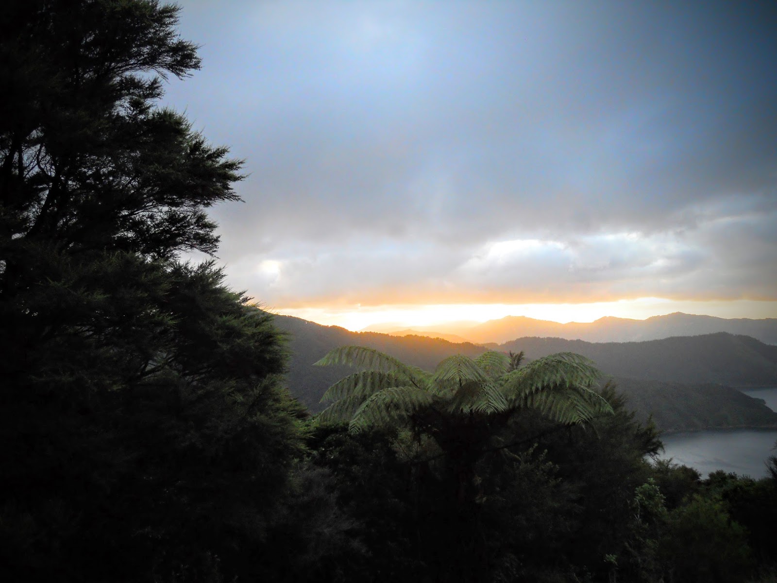
My first section of the TaT I have managed to complete this year is the section from Ship Cove to Anakiwa, following the course of the Queen Charlotte Track or QCT.
This track covers the first 71 kms of the Te Araroa in the South Island and is a relatively easy introduction to the terrain you will experience south of Cook's Strait.
 |
| On the way to Ship Cove |
Day One: Ship Cove to Madsen's Camp
I walked the track from north to south, so the first day was the section from Ships Cove to Endeavour Inlet. The ferry was about half full of walkers and half full of mountain bikers this late in the season. Personally, I was carrying all my gear as I was camping every night but most other walkers were using the cheap and efficient pack transfer system and staying at lodges/resorts. You should do this, it only costs $5 per day for a transfer and saves carrying that weight every day.
Not practical if you plan to camp every night as it does not transfer to every camp site.
Make sure you buy one of these
QCTLC Track passes before leaving Picton as you are required to have a track pass on the QCT. The cost for a 3 day pass is $12, a five day pass is $18.
 |
| The QCTLC track pass |
I travelled out to Ship Cove on the 8 am
Cougar Line ferry, but there are several companies which transport trampers and MTB riders to the various access points along the track. I just found Cougar was the cheapest over all for a return ticket, Picton to Ship Cove and then Anakiwa to Picton at the end of the track.
 |
The jetty at Ship Cove
|
 |
| Overview of the Marlborough Sounds and the Queen Charlotte Track (QCT) |
 |
| Cougar Line water taxi |
There is a very nice memorial to Captain Cook at the start off the track with several interpretative panels about his voyages and the history of the cove. Well worth a look as you will probably never visit this site again, it is only accessible by boat. Apart from the immediate area around the memorial it has been maintained as it would have been when Cook first visited.
 |
| My first Weka of the trip, many more to follow |
 |
| Entry to the Cook monument |
 |
| Captain Cook monument at Ships Cove |
 |
| Jon at the monument |
The start of the track is right at the end of the jetty and it is a rude introduction to the QCT. You walk about 10 paces and then start climbing for the next hour, the track is excellent underfoot but quite steep.
 |
| DOC sign at start of the track |
 |
| QCT: Ship Cove to Madsen's |
 |
| Start of the Queen Charlotte Track... |
 |
| ...is a bloody big hill!!!!! |
Eventually you climb high enough to gain a view of Resolution Bay, as the track nears the top of the ridge it starts to level out into a more friendly gradient. It was about 27 degrees on the day, and the humidity and heat reminded me of being in the Pacific Islands.
 |
| Resolution Bay from the QCT |
 |
| Typical dense bush at start of the track |
 |
| 3 more hours for me... |
You pass through a combination of DOC land and private land holdings along this track, that is why you require a
QCTLC track pass. Thick dense bush is inter spaced with regenerating bush as a lot of the land has been farmed in the recent past.
 |
| Regenerating forest on old farm site |
 |
| Resolution Bay from the QCT |
Eventually you reach a high point with views out to Resolution Bay and the outer Sounds, there are a couple of picnic table here with some resident Weka to keep you company. The Weka is a NZ native bird, it is the same colour as a kiwi but looks like some strange mixture of duck and chicken. I have honestly never seen so many Weka in my life, I must have spotted well over 100 over the 5 days.
Incredible!
NB: Weka are the most larcenous native bird, do not leave your gear unattended when they are around as they will steal it in a heartbeat. They decorate their nests with colourful and shiny booty.
 |
| Warren the weka comes to visit... |
 |
| View towards Endeavour Inlet |
 |
| Warren and Whilma the weka... |
Your journey along the track will be punctuated by a number of interpretive signs and also distance markers. Generally they mark 10km divisions but I have seen them as close as 1-4 km's apart as well.
 |
| Woohoo...only 61 km's to go... |
After 4-5 hours on track you will get to civilisation (or at least the local version) when you reach the bach's and
Furneaux Lodge near the head of Endeavour Inlet. I absolutely stopped for a cleansing beverage and in fact was shouted a second by some American tourists I had been walking with for most of the day.
Thanks guys, I appreciated it.
Furneaux Lodge provide superior accommodation but also do drop in bar and restaurant meals if that is of interest to you.
 |
| Holiday homes near Furneaux Lodge |
 |
| Furneaux Lodge, Endeavour Inlet |
Refreshed (but also slightly wobbly...two ciders, hot day, you get the picture...) I set off for my accommodation for the night at
Madsen's Camp about an hour distant. Madsen's is one of two campsites in Endeavour Inlet and it was well appointed with shady campsites, clean fresh water, a good toilet, access to the ocean and solar showers on offer. Tony the owner is very welcoming without being intrusive.
For $10 per night you couldn't ask for more.
 |
| Turn off to Madsens an hour down the track |
 |
| My campsite at Madsens, nice hammock |
I had a shower (awesome, the water was just about too hot to be under...) and fed and re hydrated myself before taking a quiet stroll down to the jetty (lots of edible mussels for the seafood lovers...) at the bottom of the property. They must have been having a party at Furneaux Lodge as I could hear them whooping it up from a couple of kilometer's away.
 |
| View from the tent at Madsens, Furneaux Lodge in distance |
 |
| Artistic shot from in the tent |
 |
| Dusk at Madsen's Camp |
 |
| Still looking fresh...sort of! |
So ended day one of the track.
Day Two: Madsens Camp to Bay of Many Coves Campsite
Day Two of the trip was the longest, 23 km's to cover over 6-7 hours would take me from Madsen Camp to the campsite at Bay of Many Coves. After a good breakfast (porridge with fruit, tea and plenty of water) I was on the trail before 8 am.
The day was much cooler than the previous one with cloud and a cold wind blowing up Queen Charlotte Sound.
 |
| Sunrise day two enroute to Camp Bay |
 |
| QCT from Madsen's to Bay of Many Coves |
 |
| Woo hoo... only 51 km's left |
 |
| Bit of chop out on Big Bay |
 |
| Very nice track between Madsens and Camp Bay |
My first destination for the day was the DOC campsite at
Camp Bay about 3 hours along the track. I eventually reached the site around 11 am and stopped for some lunch and water resupply.
 |
| Coming into Camp Bay |
The Camp Bay site looks really nice, there is space for about 20 tents on two terraces as well as a new shelter and easy access to the sea. I meet up with a mixed group of French and Swiss hikers here, we walked together for most of the rest of the day.
 |
| Ablution block at Camp Bay |
 |
| Shelter at Camp Bay camp site |
After leaving the campsite there is a 25 minute walk up a gravel road to get to Kenepuru Saddle. From here you follow the track up and across a series of ridges all the way to Torea Saddle and Portage some 24 km's distant. You need to take plenty of water with you as there is no re supply point until you get to the shelter at Bay of Many Covers over 13 km's away.
 |
| Climbing to Kenepuru Saddle, view of Queen Charlotte Sound |
You can see the group of French/Swiss trampers I was walking with for most of the day. As is common you stop and talk at similar places, so even though you don't know them well you get to meet and find out a lot about many groups of people as you walk along. These guys were off to the Abel Tasman Great Walk when they finished the QCT.
 |
| Kenepuru Saddle |
From Kenepuru Saddle there is a long up hill slog for about 2 hours, eventually you reach point 411, this is the high point for all of the QCT. Then it is a series of ups and downs as you follow the ridge line towards Torea Saddle.
 |
| Ah....yep! |
 |
| Looking South East to Queen Charlotte Sound |
 |
| View down to Kenepuru Sound from Kenepuru Saddle |
There are some awesome views of the Sounds from high on this ridge, make sure you take the opportunity to stop and enjoy them as you walk along...
 |
| View looking to head of Kenepuru Sound |
 |
| View west of Pelorus Sound from the track |
 |
| Mt Stoke to left in the far distance |
 |
| The QCT crosses all of those ridge lines |
 |
| The half way point 1 km before the Bay of Many Coves camp site |
I arrived at the
Bay of Many Coves Campsite about 3 pm, the mixed Swiss/French group I had been walking with continued on to the Black Rock Campsite. The shelter and campsite were nice, although a bit exposed to the cold wind blowing up the sound. I pitched my tent on one of the more protected tent site's in the bush behind the shelter.
I shared the campsite with a NZ/German couple overnight, we were the only occupants.
 |
| View from the shelter at Bay of Many Coves |
The shelter is a three sided affair with rainwater tanks for water, surprisingly they were almost all full as a lack of water here had been concerning me for most of the day. Watch out for the resident weka, he is a thieving beast who kept coming and looking under my tent fly for something to eat/steal.
Cheeky bugger!
 |
| Bay of Many Coves Shelter |
 |
| The windward tent sites at Bay of Many Coves camp site |
 |
| My tent site on the lee of the ridge |
 |
| Jon in the tent early evening |
I was still feeling quite chipper at the end of the day despite the 23 km's I had walked.
Day Three: Bay of Many Coves to Cowshed Bay
Day three was a shortish day, only 13 km's and 5 hours of tramping to get to Torea Saddle and from there to Cowshed Bay Campsite. It was a bit windy but the track is surrounded on both sides by thick bush for most of the day so the wind did not have the effect it might have in a more open area.
 |
| Beautiful sunrise at Bay of Many Coves |
 |
| QCT from Bay of Many Coves to Cowshed Bay |
 |
| Nice sheltered track on a cold windy morning |
 |
| View of Queen Charlotte Sound |
I was heading for Torea Saddle which is above the headland jutting out into Pelorous Sound from the left in the photo below.
 |
| The ridges I will be covering over the day |
 |
| Interislander ferry on way to Wellington |
 |
| Some nice areas of bush alongside the track |
 |
| Jon en route to Black Rock Shelter |
 |
| Atmospheric conditions over Queen Charlotte Sound |
 |
| Picton in the extreme distance |
You get your first view of both Picton and Anakiwa about two hours after leaving the camp site at Bay of Many Coves. It is also possible to see the course of the track as it sidles up and down the ridges.
 |
| Closer view of distant Picton from QCT |
 |
| Jon on the Queen Charlotte Track |
 |
| Take heed MTB'ers, they mean it.... |
 |
| The Blueridge ferry coming up Pelorous Sound |
 |
| 3/4 er's of the way there.... |
 |
| First view of Anakiwa in the far distance |
I stopped at
Black Rock Shelter for lunch and it was an excellent looking site with a newish shelter and well concealed tent sites. Plenty of good water in the rain tanks as well...
 |
| Black Rock Shelter |
 |
| View from inside Black Rock Shelter |
 |
| Lunch and brew in the shelter |
I tried one of the new
Back Country Cuisine soups for lunch and was most impressed, it was delicious.This one was chicken, corn and noodles it had a full flavour and big meaty chunks of chicken it it. Yum!
I will definitely be buying more of these in the future.
 |
| My tasty soup lunch |
 |
| Slowly counting down the distance... |
When you get to Torea Saddle there is a track which leads directly to the DOC camp ground at sea level. It takes about 20 minutes and starts just to the right of the DOC map board in the photo below.
 |
| Torea Saddle with view to tomorrow's track |
 |
| The war memorial at Torea Saddle |
I stayed the night at the
DOC Cowshed Bay campsite, it was busy as it had two school groups already in residence. It is in a nice spot right on the shoreline with fine views of Pelorous Bay and good amenities right next to the camp sites.
 |
| Shelter at Cowshed Bay camp site |
 |
| Toilet and cooking shelter, Cowshed Bay |
 |
| My beach side tent site, Cowshed Bay |
|
 |
| We are climbing over that tomorrow... |
 |
| Pelorous Sound from camp site |
 |
| Portage in the distance |
I was entertained for most of the afternoon by a goodly number of native birds singing and generally carrying on in the stand of fruit bearing trees along the shoreline. I've taken a short video, hopefully you can hear them...
 |
| Video of birdsong as dusk approached |
I spent a lot of time either on the beach or sitting in the shelter, as there is a lack of actual grass to sit on near the tent sites. The campsite was totally full by the end of the day with numerous camper vans as well as seven different groups of trampers and two large school groups.
 |
| Jon sitting in the Cowshed Bay shelter |
If you are staying at the camp ground and fancy a meal you can head 200 meters along the shoreline or road and eat at one of the restaurants at
Portage Resort.
I hear the food is excellent if slightly pricey (as is to be expected so far from a major town...).
 |
| Fancy a tasty cooked meal?...go to Portage |
 |
| Bellbird in tree, Cowshed Bay camp site |
I slept well that night despite the strong winds which blew in after dark, the sound of the nearby ocean was quite calming. I was quite dusty though as the grass on the tent sites had been killed off by the mass of people staying here over the last 3-4 months. If you have a choice go for the upper campsites as they were still green and shady, and only another 30 meters away from the shoreline.
Days 4 and 5 would see me walking the remainder of the track covering the area between Torea Saddle and Anakiwa...


Nice one! I'm embarrassed to say that I never set foot on the Queen Charlotte Track during my 6 years living in Picton.
ReplyDeleteAlso, the food in Portage is AMAZING!! - at least it was when we visited for an anniversary nearly 10 years go.
It would be a great track to take the kids on especially that section from Te Mahia Saddle to Anakiwa. Very nice campground at Davies Bay and its only one hour up the track from Anakiwa.
ReplyDelete